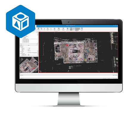
Product Info Get a Demo A 3D software environment to combine data sets from multiple mass data sensors MAGNET Collage provides data processing of otherwise disparate data sets into one 3D environment that can accommodate laser scanner, mobile scanning and mapping, road resurfacing scanners, and photogrammetric point clouds. To further simplify the combination of data, […]
Category Archives: Mobile Mapping System
Magnet Collage Web
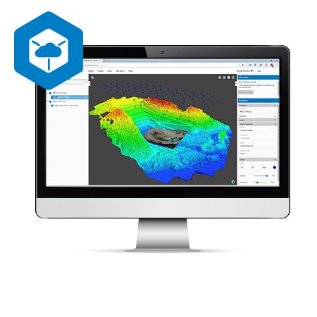
Product Info Get a Demo Collaboration made easy MAGNET Collage Web works seamlessly with MAGNET Collage so you can publish and share your 3D datasets in an easy-to-use, online program Simple access to web-based 3D data, resulting in more productive and better informed work Ultra-fast, web-based point cloud and mesh visualization Excellent browsing experience with […]
IP-S3 HD1
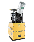
Product Info Get a Demo Compact, High Density 3D Mobile Mapping System The IP-S3 mobile mapping system offers high density, high precision, point clouds combined with high resolution panoramas from a system that is smaller, lighter and easier to handle. IP-S3’s positioning system is an integration of an Inertial Measurement Unit (IMU), GNSS receiver (GPS […]