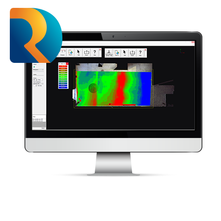
Product Info Get a Demo Floor flatness & levelness (FFL) QA software, directly integrated with Autodesk® Navisworks® Perform Floor Flatness and Levelness (FFL) analysis directly from scan data loaded into Autodesk Navisworks, on wet or dry concrete in near real-time. This software provides robust insights of flooring deviations with heat maps, contours, and grids points, […]
Author Archives: admin
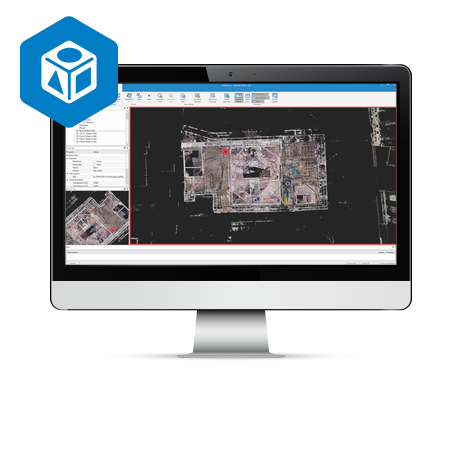
Verity
Product Info Get a Demo Find mistakes before they become expensive problems Verity from ClearEdge3D compares point clouds against design and fabrication models, allowing 100% verification of work in the time it takes to spot check 5%. Provide a complete record and validation of work installed per specification and detailed information on any deviations. Verity […]
EdgeWise
Product Info Get a Demo Reduce your modeling time by up to 75% EdgeWise™ software from ClearEdge3D offers a host of modeling features and tools that help users quickly take point clouds and convert them to usable as-built 3D plant and building models. As the industry’s most technological advanced as-built modeling platform, EdgeWise utilizes automated […]
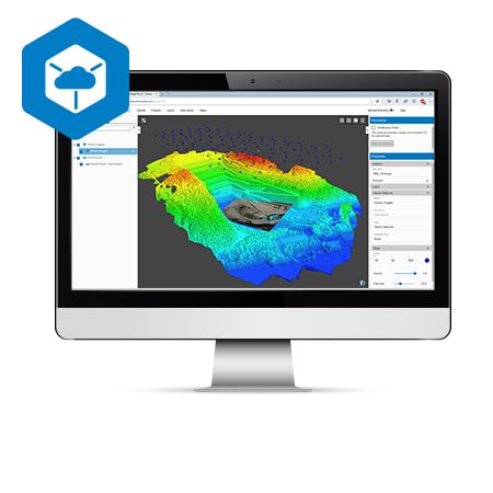
Magnet Collage
Product Info Get a Demo A 3D software environment to combine data sets from multiple mass data sensors MAGNET Collage provides data processing of otherwise disparate data sets into one 3D environment that can accommodate laser scanner, mobile scanning and mapping, road resurfacing scanners, and photogrammetric point clouds. To further simplify the combination of data, […]
Magnet Collage Web
Product Info Get a Demo Collaboration made easy MAGNET Collage Web works seamlessly with MAGNET Collage so you can publish and share your 3D datasets in an easy-to-use, online program Simple access to web-based 3D data, resulting in more productive and better informed work Ultra-fast, web-based point cloud and mesh visualization Excellent browsing experience with […]
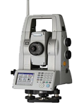
GLS-2200
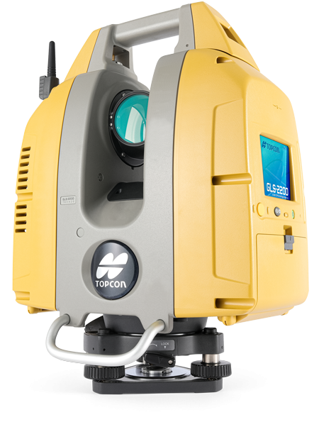
Product Info Get a Demo A high-performance scanning solution that’s simple to use Quickly tackle any job with the latest in scanning and workflow technology. The GLS-2200 features a unique survey style setup and user-friendly processing software that turn lengthy scanning processes into fast and easy workflows Unique scanning mode that can capture dense wet […]
TSshield
Product Info Support & Training Get a Demo Safeguard your investment TSshield 3.0 protects your total stations. Keep your equipment running at optimal performance with device tracking, health checks, remote access support, as well as proactive maintenance features that minimize unscheduled downtime. You’re in complete control of your total stations, with the ability to restrict […]
NET AX II Series
Feature Ultra High-precision Distance Measurement Precise Angle Accuracies 0.5″(NET05AXII)/1″(NET1AXII) 1″ Auto Pointing Accuracy* Remote Control through on-line PC Exclusive Reflector Prescan Technology Enforced Durability for Long Term Deformation/Monitoring Applications For Monitoring Engineering structures, such as buildings, dams, tunnels and bridges, can always be affected by movement caused by excavation, heavy construction and piling placement, in […]
Delta solution
Feature Better Understanding and Management of Risk Topcon Delta Solutions consist of Topcon Delta Link, Topcon Delta Log and Topcon Delta Watch. Topcon Delta Link provides hardware support for autonomous operation of total station and environmental sensor data in the field. Communication options include Ethernet, Wi-Fi and a globally approved integrated cellular modem. Topcon Delta […]
DT50 Series
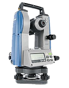
Feature Quality, Performance, and Affordability that Ensure Maximum Profitability SuperiorPerformance and Durability All models feature superior optics, mechanics, advanced absolute encoder systems, proven tilt compensators, and the industry’s highest IP66 protection grade. Power-Saving Technology Saves Battery Costs Four AA alkaline batteries provide extra-long operating time from 100 to 170 hours, saving costs for replacement batteries. […]